Activities
Activities
Below are a list of activity resources related to: interactive climate change, world data on population, plate tectonics, and solar energy. Click each drop down menu for links to resources and to learn more about each section.
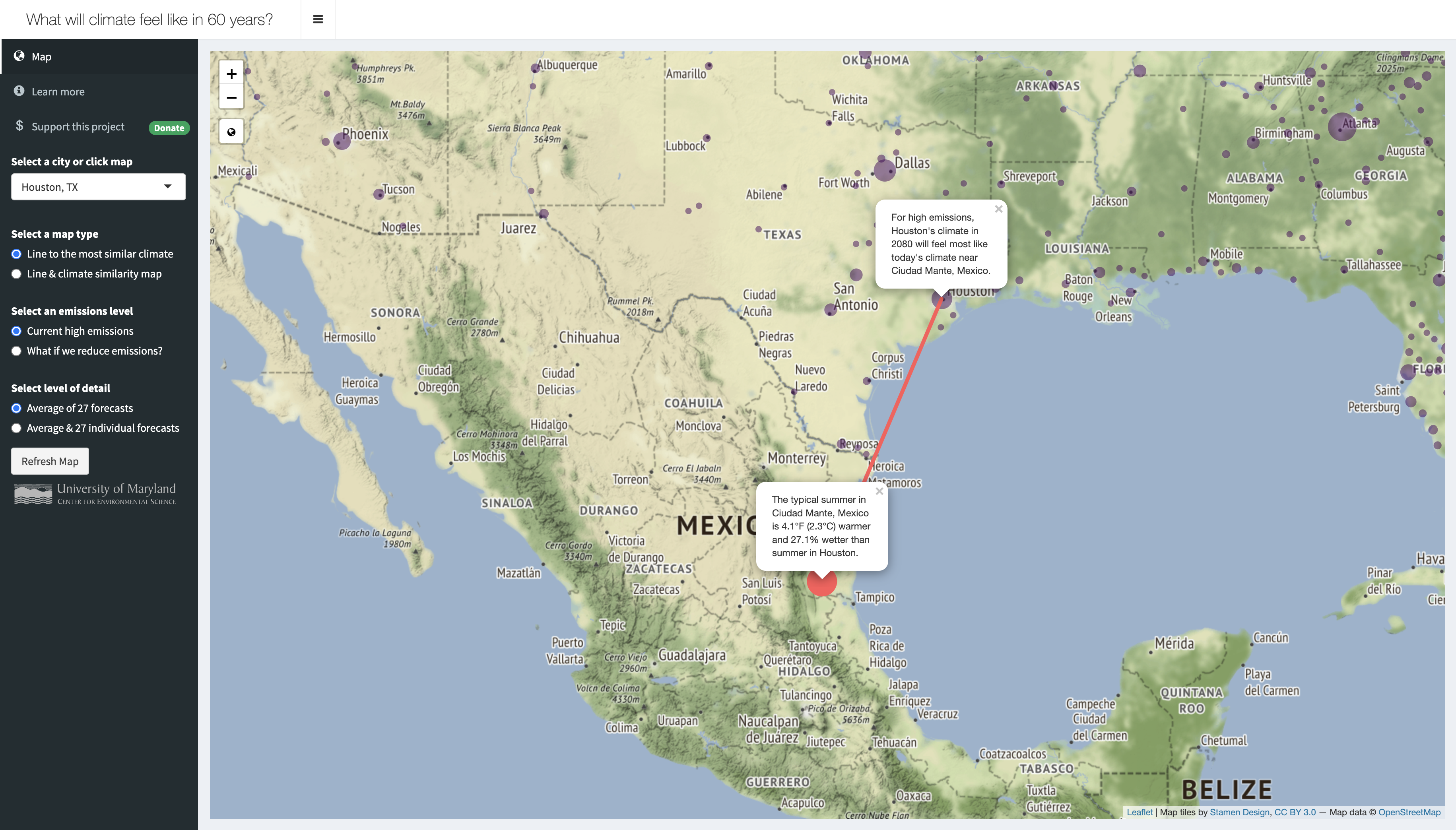
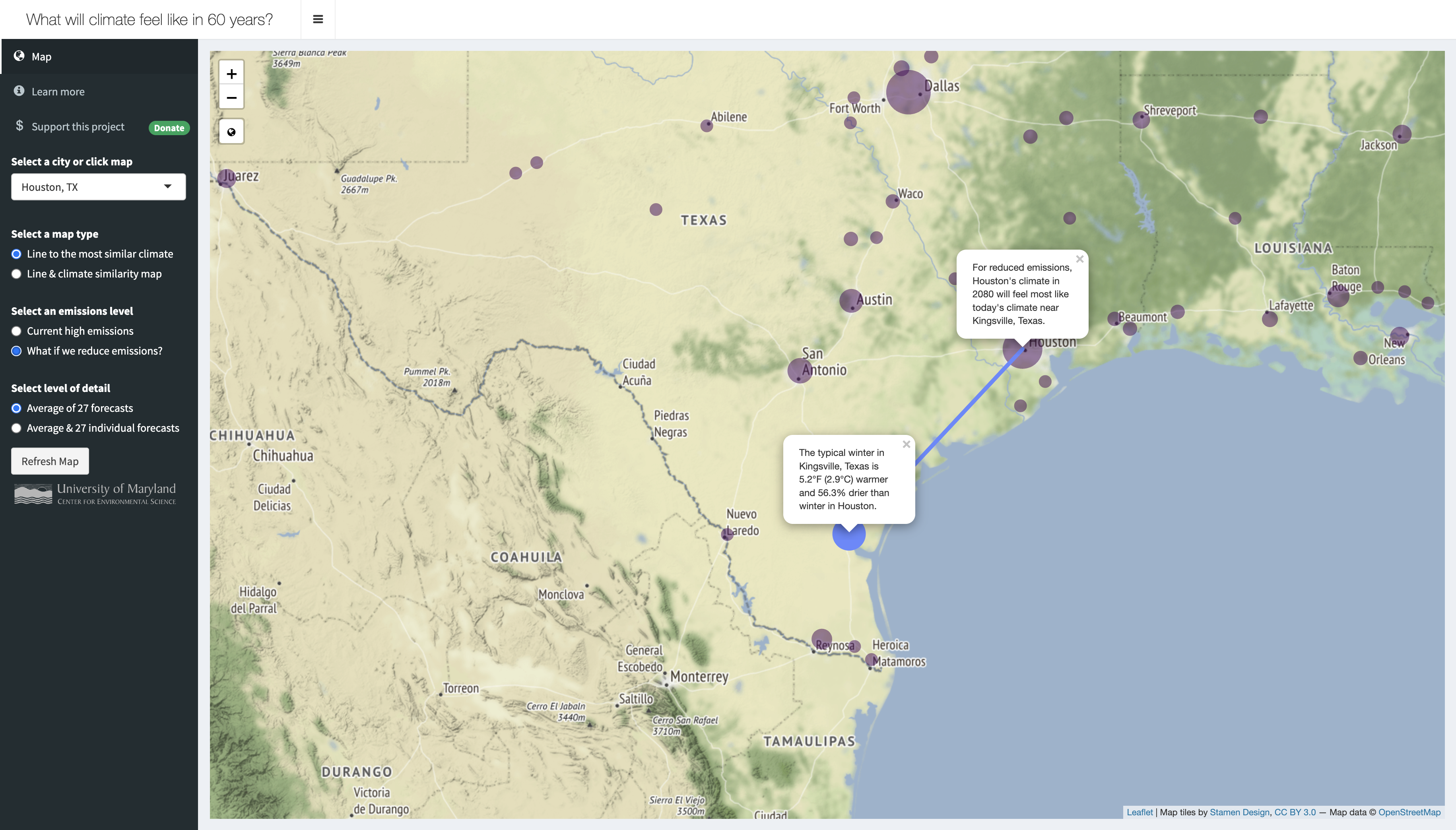
Interactive Climate Change
What will climate feel like in 60 Years? Learn more with the Interactive Climate Change tool.
High emissions example for Houston, TX:
Reduced emissions example for Houston, TX:
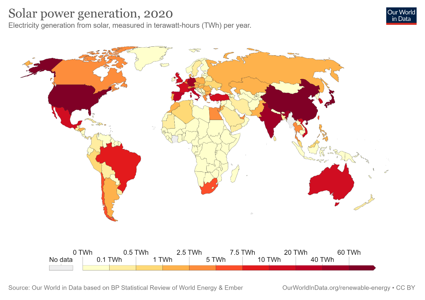
Our World in Data
Our World in Data Hundreds of graphs and ability to download raw data or tables. Well sourced. Ability to tailor graphs or charts to regions or needs.
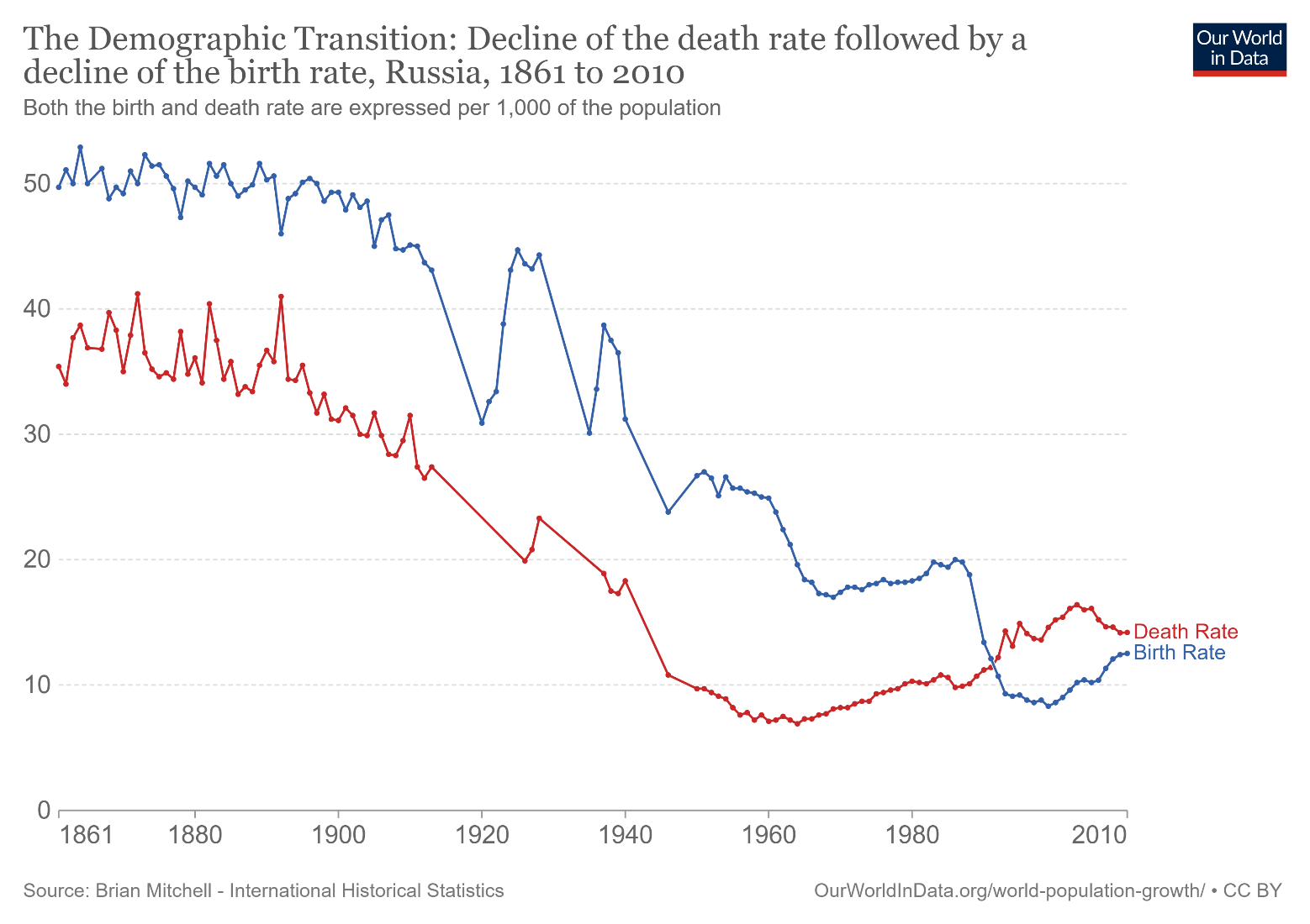
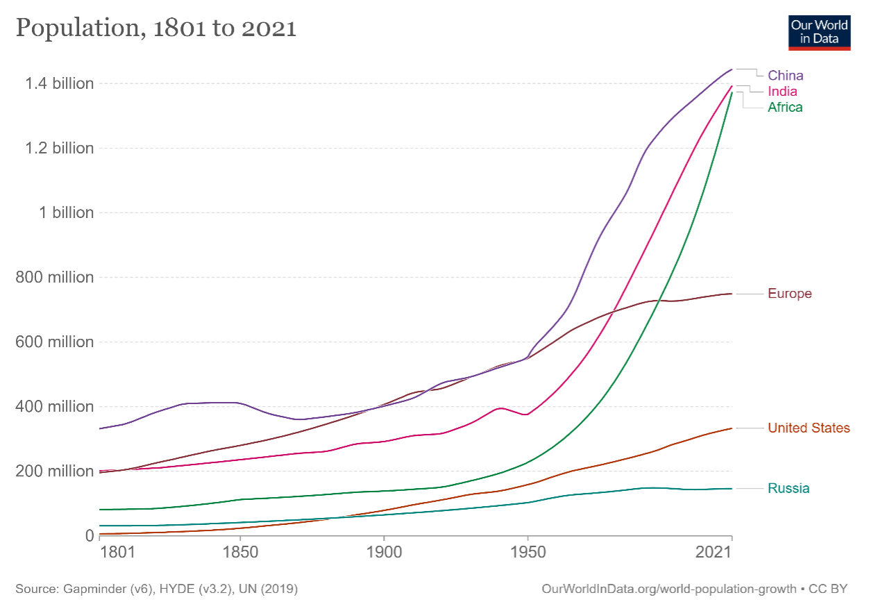
Population Growth (Our World in Data) Links:
Example for birth and death rate in Russia:
Example for population growth of U.S., Europe, China, India, Africa, and Russia:
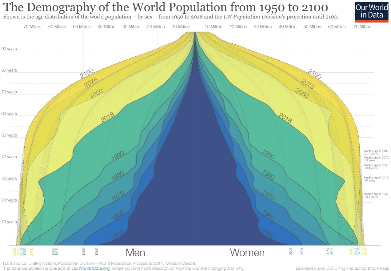
Population Pyramid Acitivity Links:
Plate Tectonics
Plate Tectonics and Historical Geographic Reference
Interactive Web Viewer for the Last 750 Million Years:
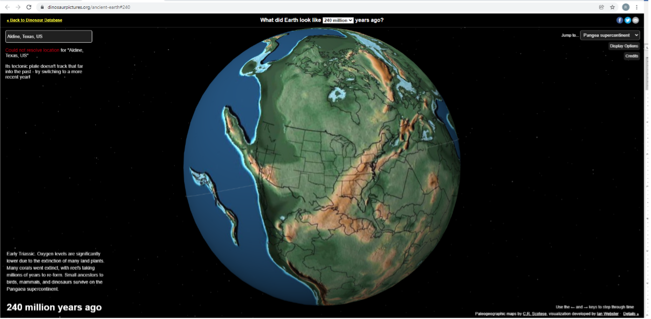
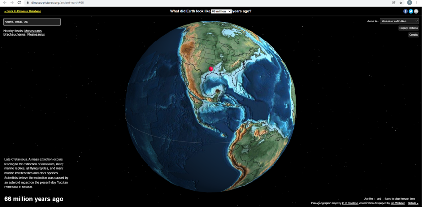
Students can type in major cities around the world to see where they were up to 750 million years ago. On the top right of the viewer, you can add the equator under “Display Options” and stop the globe from rotating if you uncheck the “Rotate Globe” box. You can also remove clouds for better viewing of the land and oceans. Under “Jump to…” you can find major historical geology events, including Pangea, dinosaur extinction, etc.
Note that some places, including Houston and Aldine, won’t show up or “track” going as far back as Pangea (or any time 170 million years or older) because the Gulf of Mexico basin was just beginning to open.
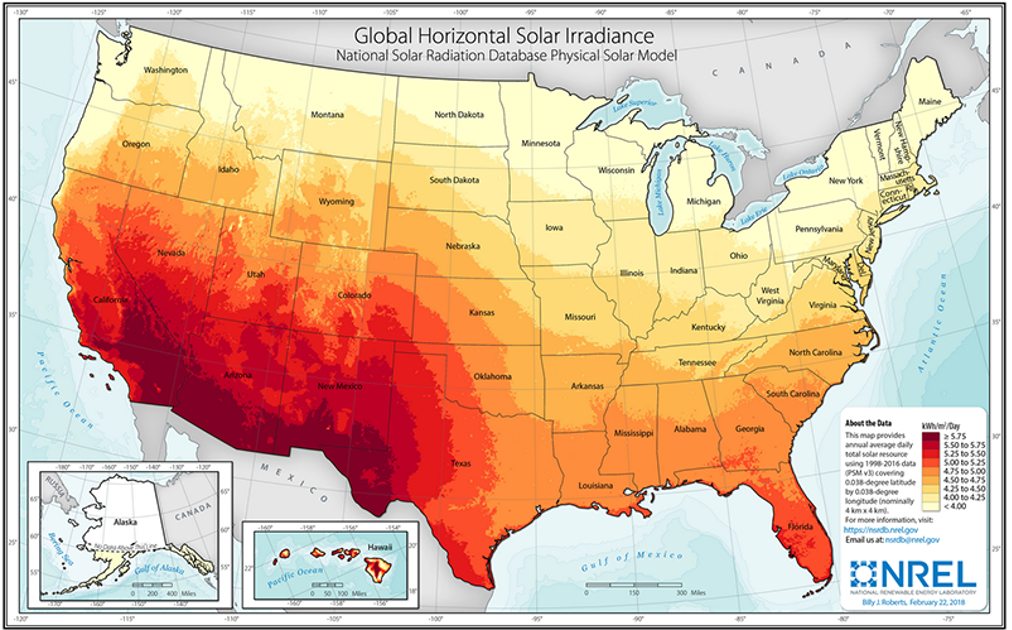
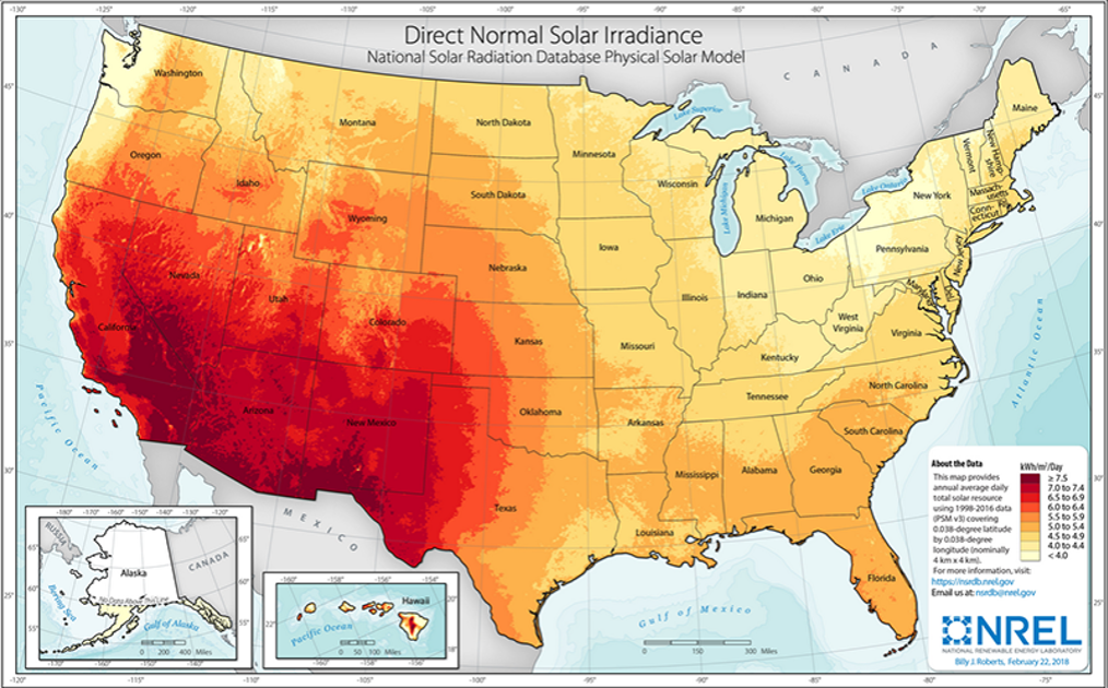
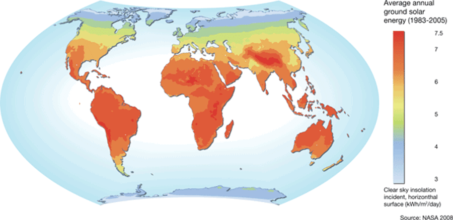
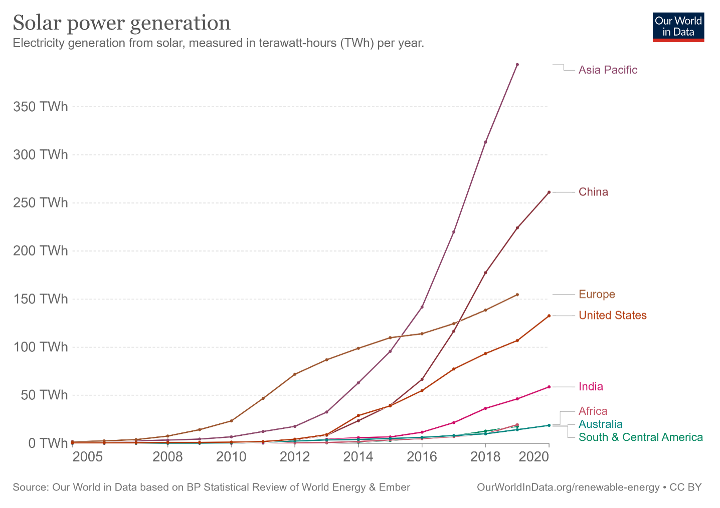
Solar Energy
Mental Maps
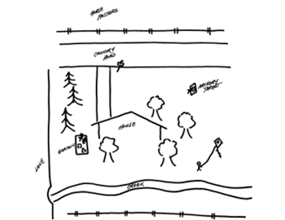
Ask students to pick a place that has meaning for them (i.e., a place that they have lived, visited on vacation, or is special to them) and draw a map of that place. Have them discuss their map. What aspects or features give that place its meaning? Are these aspects or features in physical geography (e.g., climate, landforms, etc. ) or human geography (e.g., culture, social interactions, etc.)?
Geography in Our Lives
Have students think about the geography of our daily lives. Students may consider:
- Weather (e.g. does the weather affect your activities)
- Landscape (e.g. does the landscape affect your activities, what is your preferred landscape type)
- Navigation (e.g. your sense of direction or use of technology)
- Population geography (e.g. how does population density affect where you live)
- Economic geography (e.g. what economic sector will you work in after you graduate, will that affect where you live)
- Cultural geography (e.g. does culture affect your activities)
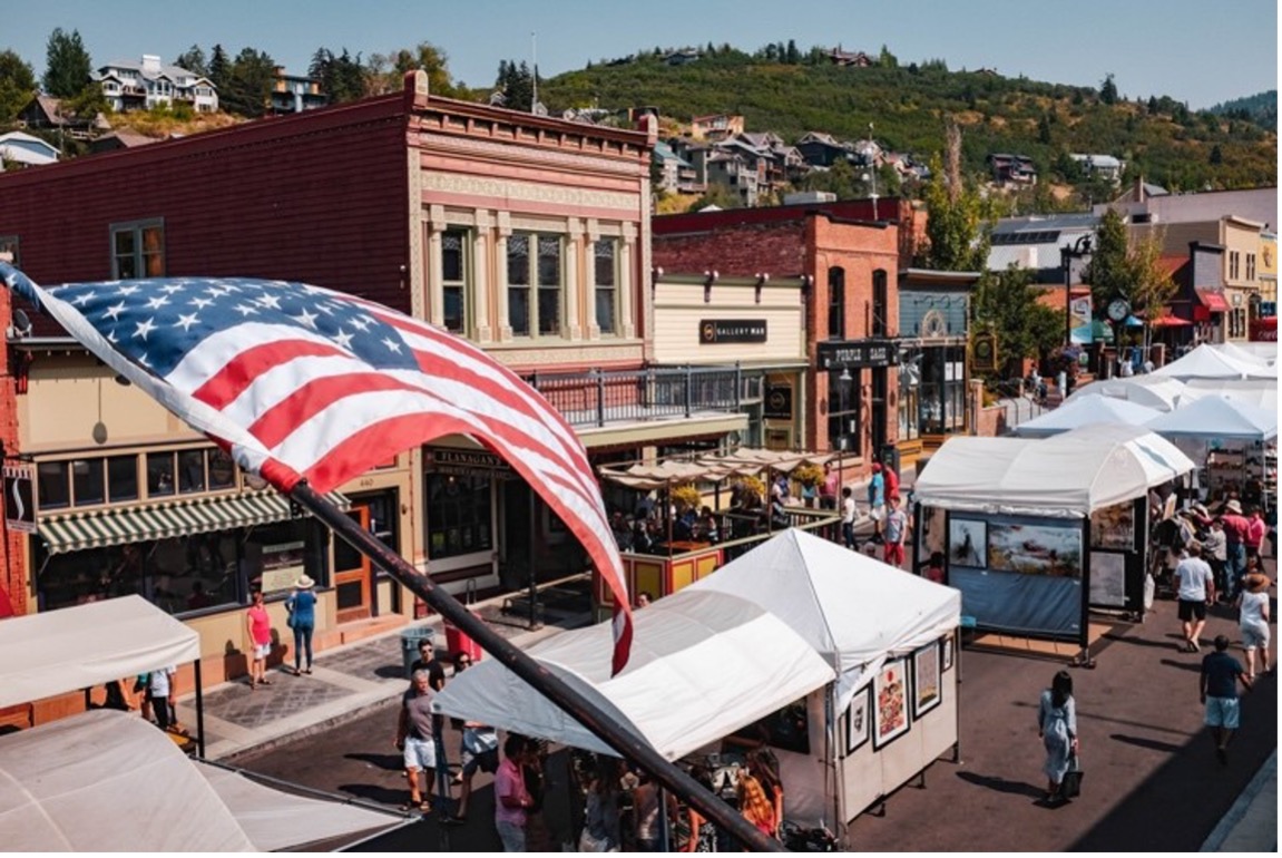
Photo by Olivia Hutcherson on Unsplash
Geography in Culture & Popular Media
Culture and popular media play an important role in how we think about places. Have students choose a cultural or media product or event (e.g., book, movie, tv show, podcast, sporting event, etc.). Have them discuss the ways in which geography is a part of or shapes this product/event. Then have them discuss the ways in which this product/event shapes their ideas about the place in which it is set or intended to represent.
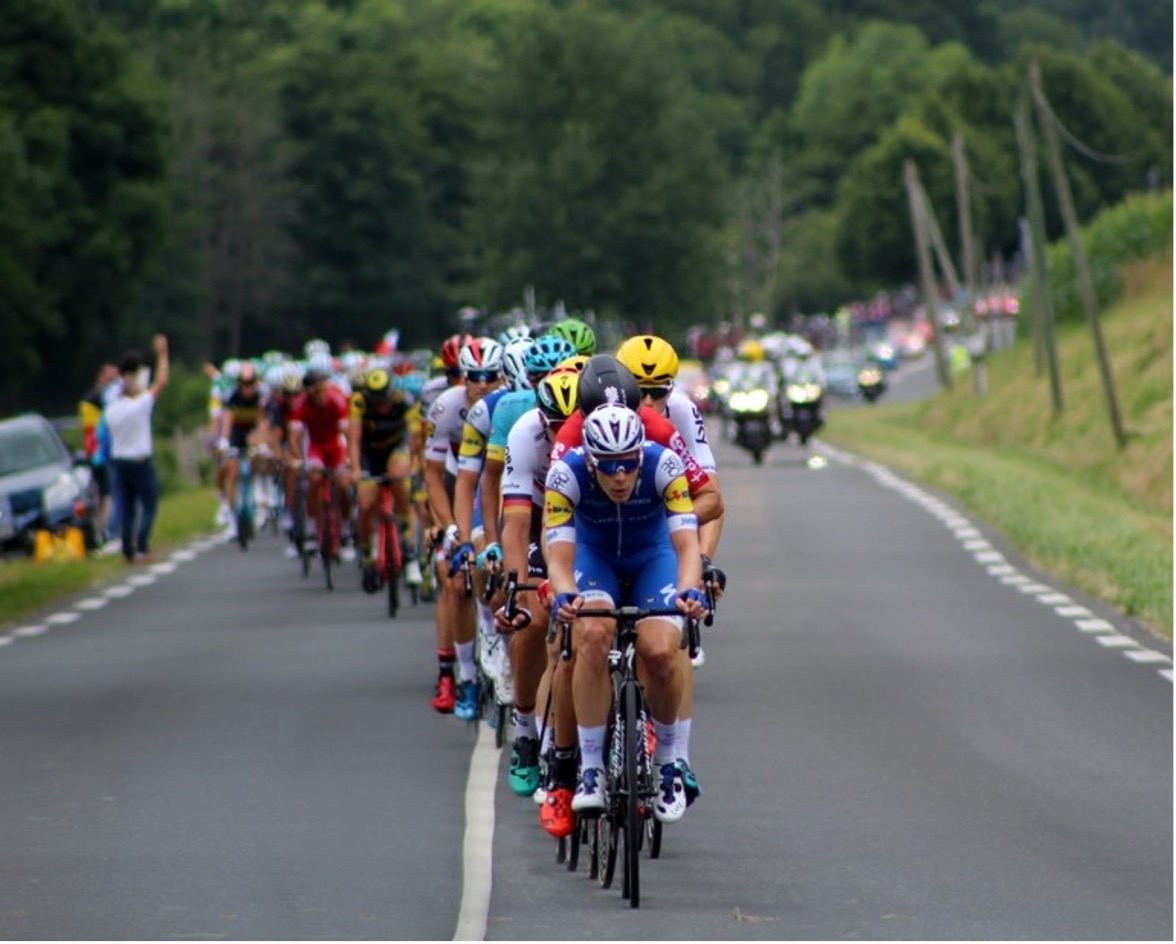
Tour de France – Photo by Rob Wingate on Unsplash
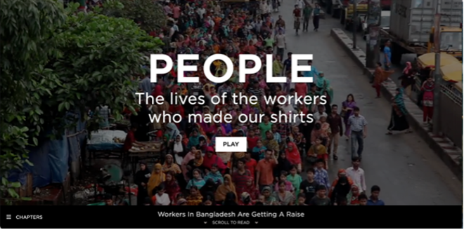
Globalization in Our Lives
Every day, we are connected to places around the world through the processes of globalization. Have students watch Planet Money Makes a T-Shirt: The World Behind a Simple Shirt, in Five Chapters. Then have them consider the ways in which globalization shapes their lives and connects them to other peoples and places through the products they use in any given day. Where do the component parts come from? Where are they assembled? How do they get to us? What peoples and places are affected by this product?
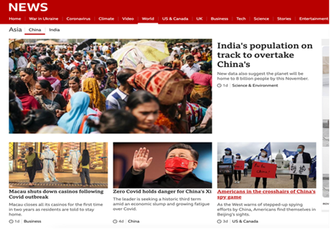
Geography in the News
Have students find a news topic and examine the geography of it. Assign news articles or have students news outlets for an article on a topic of interest. (For students in World Geography, BBC World News organizes topics into Africa, Asia, Australia, Europe, Latin America, Middle East, and US & Canada regions.) Read the article and consider the ways in which physical and/or human geography is part of or shapes the issue or event.
Regional Characteristics
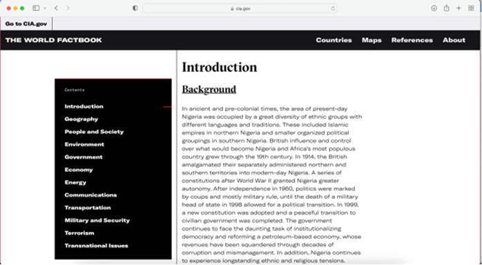
What are the characteristics of world regions and sub-regions? Assign students a country and have them read about that country in the World Factbook. Then group the students into regions or sub-regions. Have them compare the information on their countries. What are the characteristics that the countries have in common? Are these characteristics in physical geography, human geography, or both? Do the students feel that the countries in their region/sub-region have more similarities than differences? What do they feel the unifying characteristics are? How would they explain the differences?
Captioning Places
We have all heard the saying, “a picture is worth a thousand words” – and no other media outlet has embodied that saying more than National Geographic. National Geographic is well-known, primarily for its amazing photojournalism. The world knows about geography because of National Geographic. Have students take or find a picture of a place that is significant to them. It can be people, a place, a moment in time, an expression of culture, and more. Then have students write a caption for that photo that makes a connection between the subject of the photo and what they have learned in class about geography.
Geography in History
Have students think about the geographic factors behind the history they are learning about in class. For example, how did factors in physical geography, economic geography, and cultural geography shape American settlement patterns? Did these factors help or hinder settlement patterns?
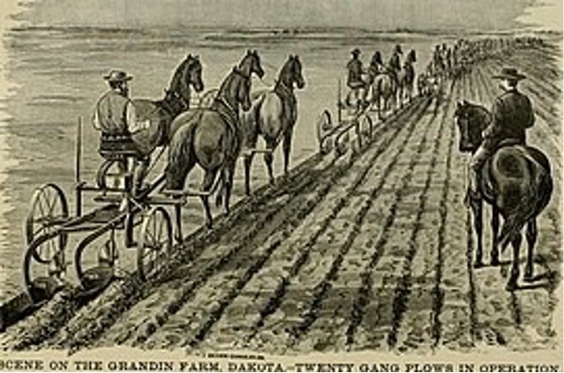
The American farmer. A complete agricultural library, with useful facts for the household, devoted to farming in all its departments and details (1882) Wikimedia Commons.