
Ecological Information System
The CBFS Ecological Information System, EIS, is analogous to a Geographic Information System, GIS. Our vision is a manipulative, online tool for examining spatial and temporal data collected at CBFS over time.
All clients of CBFS are encouraged to contribute observations for incorporation into the system. A little planning and coordination will help prioritize the effort, and standardize data collection procedures and reporting formats. Hopefully, our EIS will be able to marry with those of other field stations to ultimately create state and regional EISs. To this end, we are compiling A Guide to Ecological Monitoring and Measuring Activities at CBFS. You can use this guide to see how your interests and activities can be adapted to support the collaborative efforts of the CBFS user community.
Today, the project is in its infancy. All we have to offer is a map and a few tables.
Map 1: The Base Map (We plan to have this operational in the fall of 2016)
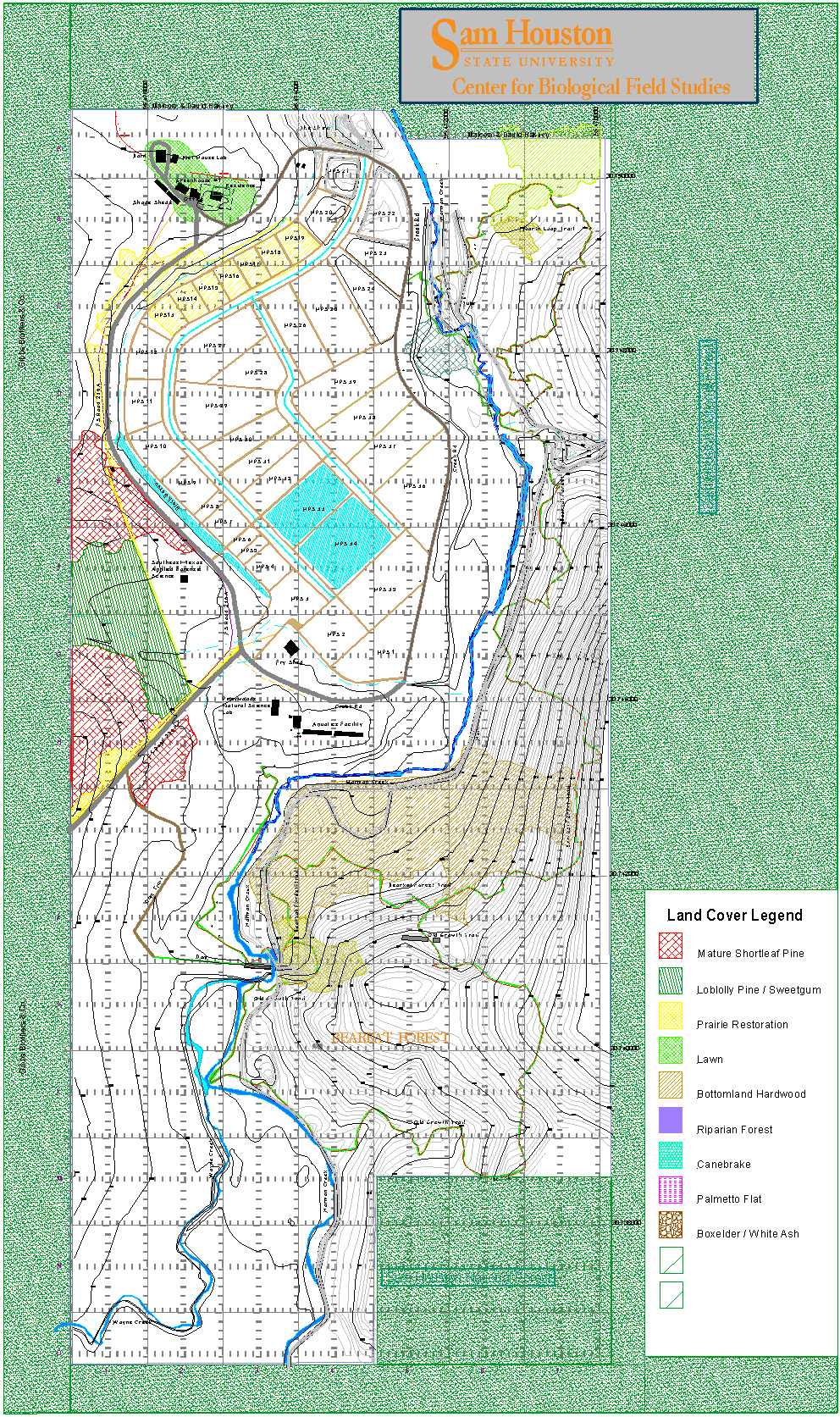
- 1 foot contour layer
- 5 foot contour layer
- Buildings layer
- Labels layer
- Latitude & longitude layer
- Mesohabitat Patches layer
- Research sites layer
- Roads & trails layer
- Surface water layer
- Survey transects & plots layer
- Utilities layer
Table 1: Checklist of Life at CBFS
Table 2: Collections of CBFS